 blog.gov.je
Behind the scenes in the Infrastructure and Environment Department’s Jersey Property Holdings directorate, a small two-person team play a vital role in keeping Jersey’s mapping service running smoothly.
Like many, you may wonder what a job in mapping looks like. We spoke to Eleanor Brayshaw, Senior Geographic Information Systems Analyst, who explained that the work and complexities involved with mapping software spans much more than you might expect.
“We work across loads of different teams, I’d say pretty much within most, if not all departments. We do a lot with the team in Natural Environment whose work involves a lot of surveying out in the Island.
Saving lives
“Part of my job is to make sure this data is sent out to emergency services where they use this in dispatch, so they can find locations quickly and accurately“
One of Eleanor’s responsibilities is ensuring critical location data is available and up to date for Jersey’s Blue Lights Services.
“I work closely with the Address and Location team who track addresses and map where they are in relation to their front door. Part of my job is to make sure this data is sent out to emergency services where they use this in dispatch, so they can find locations quickly and accurately.”
Turning data into decisions
While accurate addressing helps saves lives, it’s only one part of the team’s day to day work. Much of Eleanor’s day is spent developing mapping solutions to help teams work more efficiently.
“I work with different departments to see what their needs are and create digital tools using maps to improve efficiency. Whether that be just exploring locations or surveying on site to immediately alert colleagues in office. I really enjoy training people to do their own mapping and seeing them be able to make more informed decisions using the tools I’ve made them. I also just love finding out about the great work other teams across Government are doing!”
Jersey maintains its own mapping datasets which are looked after by Eleanor and used by businesses and utility companies across the Island.
Eleanor added: “Think of the Ordnance Survey in the UK, we effectively fulfil that role for the Island. We produce all our mapping locally and are responsible for the creation and ownership of its associated copyright.”

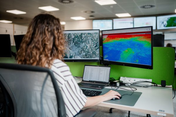
The conversation with Eleanor started at her computer screens where she demonstrated the mapping software she’d been using that morning to edit maps for the Statistics Jersey team. Our chat continued near La Frégate where she carried out survey work.
“We need to maintain the maps and monitor for updates to keep them accurate and valuable. For example, we monitor land-use changes and will use aerial photos taken from a plane to compare year on year. We also rely on input from the public, parishes, addressing team, and planning systems. It is a lot about communication with people, as well as keeping track of developments throughout the year.”
What’s your favourite map?
Dozens of maps are available on gov.je. Among the most popular is the recently launched Asian Hornet Map, which has transformed how Islanders can report sightings. There’s also the Seawater Monitoring Map, the Free Period Products Map, and the School Catchment Map.
Curious to find out what Eleanor’s favourite map is, she said: “I would say the Rooftop Solar Panel Suitability map is my favourite. It’s a really good showcase of a complex analysis that uses our 3D data to help decision-making for Jersey Property Holdings, but doubles up as something for public use as well. I also love the Cycle Rack Location map which I’ve personally used while out and about.”
Although much of their work is happening behind screens, the mapping team is helping underpin services used every day by Government, emergency responders, businesses, and Islanders. Through accurate, accessible mapping data, they play an important role in Keeping the Island Running.
