 blog.gov.je
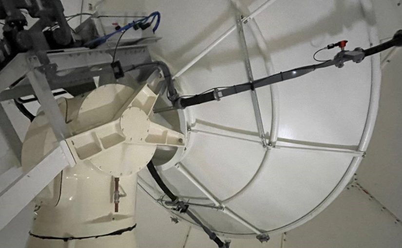
The Channel Islands weather radar, a well-known landmark at La Moye in Jersey, is a very important tool for both weather forecasters here and further afield.
It works continuously 24 hours a day, so understandably needs to be taken out of service for essential maintenance from time to time.
Today, alongside the routine radar system maintenance, the opportunity is being taken to maintain the dome itself. The radome, or cover for the actual weather radar, also needs occasional maintenance, and this week it’s having a new waterproof coating.
Jersey Met is working with Raise Telecom Ltd and The Met Office to make sure this is done to a high standard, ensuring the radar continues to work at its best.
The local weather radar data is very widely used by forecasters at Jersey Met and in neighbouring Met Offices; by the many Channel Islanders who look at our website and in weather computer models to aid forecasting.
What is often less appreciated is that if you look at almost any weather radar image that includes our area on a website or app, data from our radar will be in there as a crucial part of the network image.
When an individual radar is out of service, neighbouring radars do take over to some extent, however as the data is further away from their site the quality and detail is not as good.
The data closest to the radar itself provides the best detail and quality, and this deteriorates the further away you go. So, the best network pictures will involve multiple radars distributed over the large area. When the local radar is out of service radars in France and the United Kingdom do extend into our area and provide some detail, but they can’t be as good as the local radar itself. If you’re looking at a weather app, or online radar image, our own local radar is in there providing information for the Channel Islands and the area between French and British weather radars.
The UK and Ireland weather radar network is made up of 18 radars, 15 of which are operated by the Met Office, others including ours and those operated by Met Éireann come together to create the wider composite image. These radars are working continuously 24/7/365 completing multiple scans at different elevations every five minutes.
Radars use electromagnetic pulses and measure how long it takes for the pulses to return to the radar when they have hit rain drops, hail or snowflakes. The colours on the image show different intensities of rainfall, so we can estimate how much rainfall there is. However, it’s worth noting that drizzle can often be under reported, as the radar beam struggles to pick up the very small droplets.