 blog.gov.je
Statistics just released by the United Kingdom Met Office confirm that the Channel Island weather radar data was available 98.7% of the time throughout 2021. The figures are based on the percentage of radar images taken every five minutes, reaching the Met Office UK network. This ranks the Channel Island weather radar as one of the best and most reliable.
“These are really good statistics for our radar,” said head of Jersey Met, John Searson.
“The Channel Islands’ weather radar ranked third out of 16 radars that feed into the UK Network. During 2021 we have had a few electrical problems contributing to some loss of the regular radar images, but with replacement electrical components now installed, we hope that we will see the reliability improve again in 2022.”
In simple terms, weather radars send out a microwave pulse which is reflected by precipitation, the pulse returns to the radar and the systems are able to calculate where the individual raindrops are. This data is most commonly shown on radar maps in near real-time for use by forecasters and the public alike.
Data from the Channel Island radar is sent to UK for processing and appears within the UK radar network within five minutes. The network data is also used within the wider European radar network within just 10 minutes of the data time.
The weather radar data is then available for use in other apps and websites that show radar rainfall and by meteorologists and agencies worldwide. These include numerous computer weather models that help with forecasting and the local data is used across the world, in almost real-time.
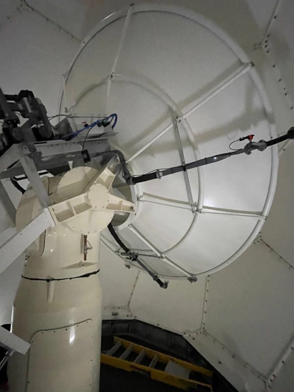
Manual observations of the weather taken by meteorologists around the globe have reduced significantly over recent years, but weather radar is very useful to fill in detail of what is missing, the Channel Island weather radar takes an image across a distance of 250km every five minutes at a resolution of 1km – that’s more than five million weather observations made daily from just the local radar system.
While it is important to be able to see rainfall on our local radar, it is equally important when there is no rain detected, as this is used by computer weather models when forecasting.
The weather radar does need to be taken out of service for routine and preventative maintenance, this does affect the statistics, but where possible this is planned during forecast dry periods.
The CI weather radar plays an important role in modern day weather forecasting and its location in Jersey fills the gap between the UK and European weather radar networks, an essential tool in aviation and public weather forecasting. The local radar site was built and commissioned in 1991 and saw a major upgrade take place in 2016 to bring the radar up to modern day technology. The radar is built to UK Met Office design.